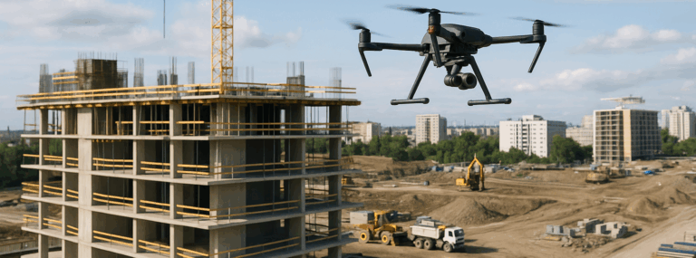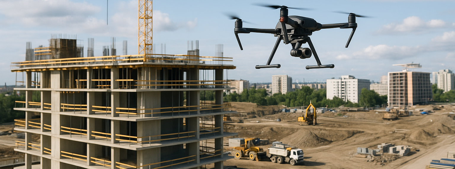
In today’s fast-paced construction industry, efficiency and accuracy are key to staying competitive. Traditional data collection methods, while effective, often fall short in providing the level of detail and speed required for modern construction projects. This is where advanced drone technology and orthomosaic mapping come into play. Companies like Humbird Visuals are transforming the way construction teams gather, process, and visualize site data through state-of-the-art aerial solutions.
What is Orthomosaic Mapping?
Orthomosaic mapping is the process of creating a highly accurate, geo-referenced map from a series of drone-captured aerial photographs. These images are processed and stitched together using advanced software to produce a single, seamless image that maintains uniform scale and eliminates distortions caused by camera tilt or terrain elevation changes. The result is a detailed and accurate representation of a construction site that can be used for planning, surveying, and progress monitoring.
Benefits of Orthomosaic Maps
The benefits of orthomosaic mapping are extensive. By using drones to capture high-resolution aerial imagery, construction teams gain access to a comprehensive visual record of their project site. This allows for accurate volume measurements, terrain analysis, and even 3D modeling. Unlike traditional surveying, which can be labor-intensive and time-consuming, drone-based orthomosaic mapping is both faster and safer, reducing the need for workers to be physically present in hazardous areas.
Why Drones Are Revolutionizing Construction Data Collection
Drones have become indispensable tools in the construction industry, offering a cost-effective and efficient way to gather real-time data. From site inspections to detailed progress reports, drones help construction professionals make better-informed decisions. With high-resolution cameras and advanced sensors, drones can capture imagery and data that were previously difficult or impossible to obtain without expensive manned aircraft or ground surveys.
Safety and Efficiency Advantages
Safety is a top priority in construction, and drone technology significantly reduces the risk of accidents. Instead of sending survey teams into potentially dangerous environments, drones can capture the necessary data from above. Moreover, drones can cover large areas in a fraction of the time it takes for traditional methods, allowing projects to stay on schedule and within budget. To learn more about drone services and orthomosaic mapping, construction professionals can explore innovative solutions tailored to their needs.
Applications of Orthomosaic Mapping in Construction
Orthomosaic maps are used in various stages of construction projects. During the planning phase, they provide detailed site surveys that help identify topographical challenges and optimize project layouts. As the project progresses, these maps serve as a reliable reference for tracking development, identifying discrepancies, and documenting changes over time.
Site Analysis and Planning
By using drone-based orthomosaic maps, construction managers can perform in-depth site analysis. These maps provide insights into elevation changes, drainage patterns, and other critical site conditions. This information can inform design choices, logistics planning, and environmental considerations, ensuring that projects start on the right foot.
Monitoring Project Progress
Regular drone flights and orthomosaic updates allow teams to monitor construction progress with unmatched clarity. Instead of relying solely on ground-level inspections, stakeholders can view a comprehensive aerial overview of the project, which makes it easier to assess work completion, schedule adherence, and identify any potential delays or issues.
Drone Videography and Visual Storytelling
In addition to technical mapping, drones excel at creating high-quality video content that captures the essence of construction projects. Drone videography not only provides stunning visual documentation but also enhances communication with clients, investors, and stakeholders. High-resolution videos can showcase project milestones, highlight progress, and offer immersive perspectives that are simply not possible with ground-based cameras.
Marketing and Client Presentations
Drone videography can be used as a powerful marketing tool, helping construction companies showcase their expertise and project portfolio. A well-crafted aerial video can highlight the scale, precision, and quality of a project in a visually compelling way. For companies looking to stand out in a competitive market, this type of visual storytelling can make all the difference.
Data Processing and Integration
The true power of drone technology lies in how the captured data is processed and integrated into construction workflows. Advanced software can generate 3D models, volumetric measurements, and elevation maps, all of which can be seamlessly incorporated into CAD or BIM systems. This integration streamlines planning and decision-making, reducing costly errors and increasing project accuracy.
From Raw Data to Actionable Insights
After a drone flight, the raw images are processed using specialized software to create detailed orthomosaic maps and 3D point clouds. These outputs provide construction managers with actionable insights, enabling them to quickly assess site conditions, measure progress, and plan future tasks. By using data-driven decision-making, teams can avoid unnecessary delays and budget overruns. To find out more about orthomosaic mapping at Humbird Visuals, visit their website and explore their cutting-edge services.
Future of Drone Technology in Construction
The role of drones in construction is set to expand even further as technology continues to evolve. Emerging advancements like AI-powered image recognition, real-time data streaming, and autonomous drone flights are pushing the boundaries of what is possible. In the near future, construction teams will rely even more on drone-based solutions for real-time project management, predictive analysis, and automated inspections.
Staying Ahead of the Curve
Companies that adopt drone technology now are positioning themselves for long-term success. The ability to collect accurate, real-time data quickly and cost-effectively provides a competitive edge in a demanding market. Partnering with an experienced drone service provider like Humbird Visuals ensures that construction teams have access to the latest innovations and professional expertise.
Orthomosaic mapping and drone data collection are revolutionizing the construction industry by improving accuracy, efficiency, and safety. Whether it’s for site analysis, project monitoring, or creating visually stunning marketing content, drones are proving to be an invaluable asset. Discover how their cutting-edge drone solutions can help take your construction projects to the next level.